
Firefighters continue to make steady progress on the lightning-caused Shingle Fire, which has now grown to 66,299 acres. As of Friday morning, containment has increased to 8 percent. In a significant update for local travelers, Highway 26 is now open.
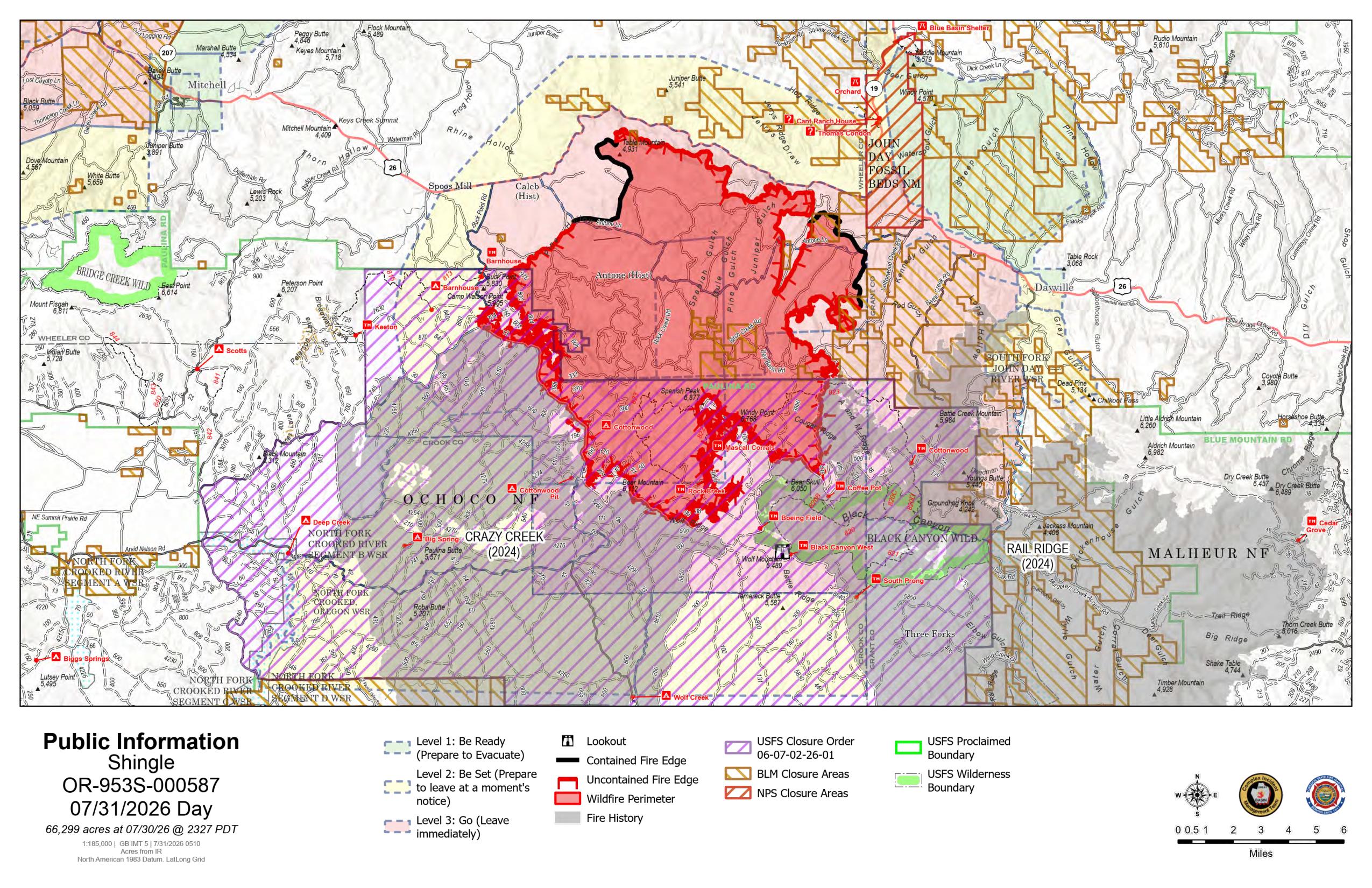 Shingle Fire Map from July 31, 2026.
Crews are using drones, along the Highway 26 corridor to conduct infrared flights. This technology allows firefighters to identify isolated pockets of heat and remaining hotspots in the steep, rocky terrain with high precision, improving overall safety and efficiency.
Ground operations today include:
- East Side: Firefighters are engaged in a direct attack in the Kangaroo Basin area.
- Southern Edge: Crews are constructing indirect containment lines in the Boeing Field area to keep the fire north of Nichol Spring and prevent it from spreading between two previous burn scars.
- Western Flank: Strategic firing operations are moving from south to north toward the forest boundary to reinforce the road system as a primary fire line.
- Night Shift: A night shift is now fully established to hold the fire’s edge and extinguish interior pockets of heat.
Because of the successful suppression efforts and a reduced threat to homes, the Oregon State Fire Marshal Blue Incident Management Team and one structural task force are demobilizing. Two task forces remain on-site to focus on the fire’s east flank as work continues. A total of 590 personnel are currently assigned to the incident.
Weather and Hazards: Conditions will remain hot and dry today before the arrival of a dry cold front on Saturday. A Fire Weather Watch has been issued for Saturday due to the potential for low humidity and strong, shifting winds that could challenge existing containment lines.
Smoke from this and other regional wildfires continues to impact air quality and visibility. Residents can find current air quality forecasts at fire.airnow.gov.
Community Meeting: Fire managers and local agency representatives will host a community meeting today, Friday, July 31, at 2:00 p.m. at the Community Hall (132 Franklin Ave) in Dayville. The meeting will also be live-streamed on the Ochoco National Forest Facebook page.
Evacuations and Closures: While Highway 26 has reopened, evacuation orders remain in place for much of the fire area. Most of the Ochoco National Forest remains closed to public access, and the John Day Fossil Beds National Monument is closed. Residents are encouraged to use official QR codes provided by local agencies for the most current evacuation maps and closure information.