
Oregon State Fire Marshal structural protection resources have demobilized from the Rowe Creek Complex. The threat to communities and infrastructure significantly diminished and local resources have adequate staffing and equipment to respond to any needs.
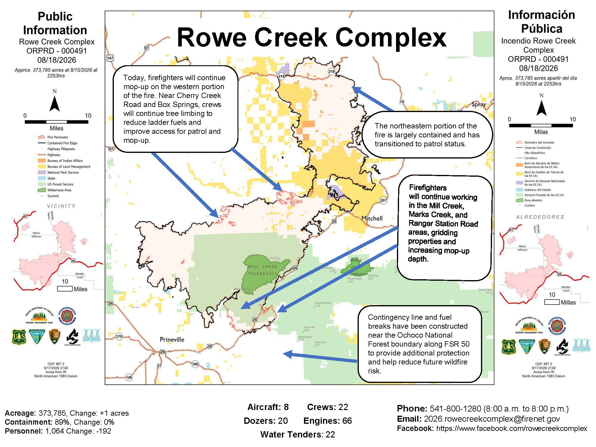 Rowe Creek Complex Activity Map from August 18, 2026.
The lightning-caused fire has burned an estimated 373,785 acres and is now 89 percent contained. As of Tuesday morning, 1,164 personnel remain assigned to the incident, which is being managed by Matt Howard of the Oregon Department of Forestry.
State structural resources departing the incident expressed gratitude to the Prineville community for its support and hospitality throughout the response. While the Oregon State Fire Marshal task forces have returned to their home agencies, wildland crews are continuing mop-up and patrol operations to secure the fire's perimeter.
Firefighters made steady progress overnight, working deeper into the fire's interior to extinguish remaining heat sources. Operations are currently focused on the western portion of the fire, including Mill Creek, Marks Creek, and Ranger Station Road. Crews are utilizing thermal imaging cameras and unmanned aircraft systems to locate residual heat. In the northeastern sector, the fire is largely contained and has transitioned to patrol status.
A warming and drying trend is expected to continue Tuesday, with high temperatures, low relative humidity, and northwest wind gusts of up to 20 mph. These conditions may contribute to increased fire activity or visible smoke within the fire's interior.
Drivers are reminded to use caution on area roadways as fire suppression traffic remains high. A 45-mph speed limit is in effect on U.S. Highway 26, and drivers are asked not to stop or park along the roadway as heavy equipment continues to enter and leave the fire zone.
Evacuation orders remain under the authority of local sheriff’s offices. Residents can monitor current levels and access smoke relief resources through the following links:
- Evacuation Information: Crook County Sheriff’s Facebook | Interactive Map
- Road Conditions: TripCheck.com
- Air Quality and Smoke: AirNow.gov | Smoke Outlook
- Official Updates: Rowe Creek Complex Facebook
- Public Land Closures: BLM Restrictions | Ochoco National Forest
A temporary flight restriction is in place to protect aerial firefighting operations. Unauthorized drone use is prohibited and will force the immediate grounding of all firefighting aircraft. For more information, the public can call the fire information line at 541-800-1280.