
Firefighters on the Rowe Creek Complex are bracing for a Red Flag Warning today as the massive lightning-caused blaze reached 373,777 acres and 79 percent containment.
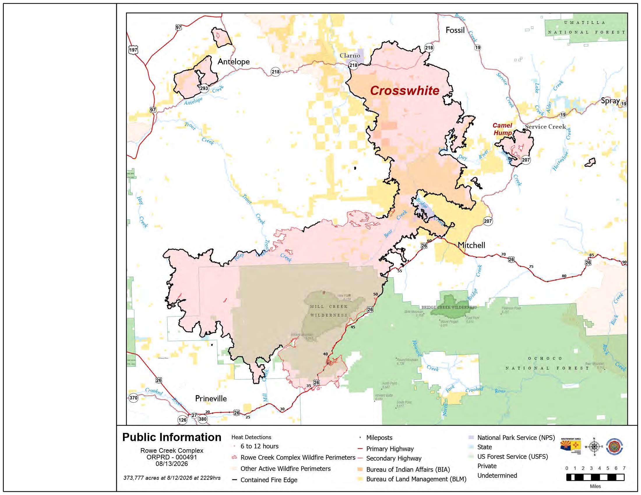 Rowe Creek Fire Map from August 13, 2026.
The National Weather Service warning, in effect from 1 p.m. to 9 p.m., brings a double threat of dry lightning and erratic winds gusting up to 40 mph. Fire managers warned that these conditions could reignite smoldering fuels and test the 107.1 miles of uncontained fire line that surround roughly 30,000 acres of uncontrolled ground.
Crews have completed intensive work along the U.S. Highway 26 corridor to prepare it for reopening. Firefighters removed hazard trees, extinguished hot spots, and utilized chipping strategies to stabilize the route. While the highway's reopening is imminent, Ranger Station Road (County Road 23) and Forest Service Road 2610 will remain closed to the public. Travelers are urged to monitor tripcheck.com for the official announcement and are reminded not to stop on the highway as fire suppression activity continues.
In the Mill Creek area, ground crews successfully used direct extinguishment and dozer lines to stop the fire's advance as it backed downslope toward developed areas. In the southern sector, repairs to Keystone infrastructure have allowed portions of the local electric grid to be reenergized.
- Structural Defense: Structural task forces are expanding mop-up operations to 200 feet around buildings in the Marks Creek and Mill Creek areas.
- Active Firefighting: Along Cherry Creek and Tompkins Pass roads, crews have successfully brought "black" (burned-out areas) to the edge of the lines, though infrared drones continue to detect lingering heat.
- Public Meeting: A meeting is scheduled for 6:00 p.m. today at Barnes Butte Elementary School (1875 NE Ironhorse Drive, Prineville). It will also be livestreamed on the official Facebook page.
Evacuation notices remain in effect for portions of Crook, Jefferson, Wasco, and Wheeler counties. A Red Cross shelter is currently operating at the East Side Church (3174 NE Third Street) in Prineville.
Air quality in the region remains unpredictable, fluctuating between good and hazardous levels. Residents can monitor real-time conditions at fire.airnow.gov.
A temporary flight restriction is active; the use of unauthorized drones is illegal and will immediately ground all firefighting aircraft.