
Firefighters on the Rowe Creek Complex are engaged in an active firefight on the fire's southern edge as the lightning-caused blaze reaches 371,548 acres. Despite 84 percent containment, fire crews spent Sunday night battling spot fires that jumped containment lines along Ochoco Ranger Station Road.
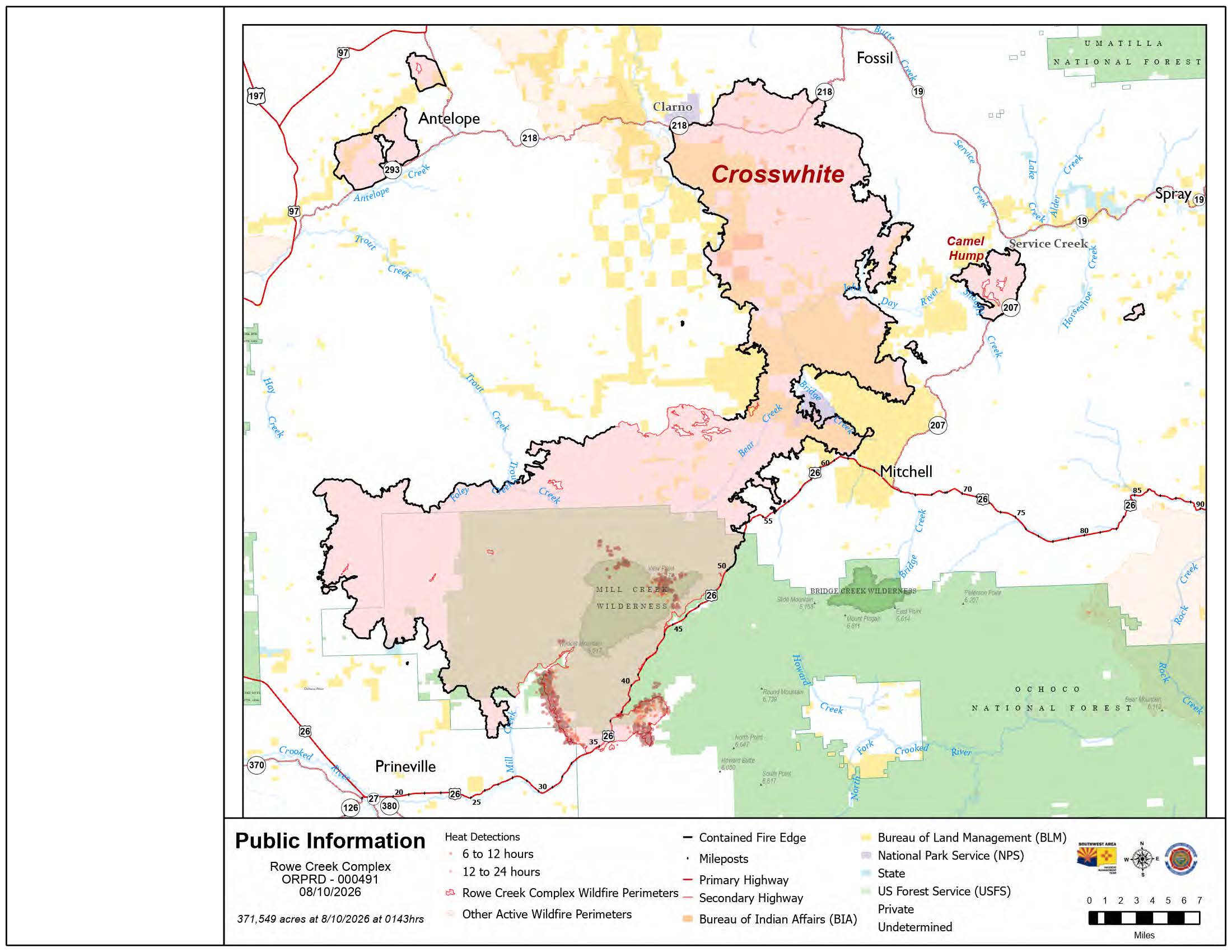 Rowe Creek Fire Map from August 10, 2026.
The 1,604 personnel assigned to the incident are facing very high fire activity. While crews successfully held lines near Cherry Creek and Tompkins Pass, the fire advanced further southwest toward Salmon Creek Road this morning. Fire managers noted that burning juniper trees are complicating suppression efforts, as their bark produces stringy embers that float across lines to start new fires.
The fight comes as the National Wildland Fire Preparedness Level has reached PL5, the highest possible rating. With 94 large fires currently burning across the country, high-value resources like hotshot crews and aircraft are in extremely high demand. The Oregon State Fire Marshal Red Team is currently overseeing structural protection, aided by additional fire engines and crews arriving from California.
Conditions today are expected to be slightly cooler with a high of 84 degrees and humidity dropping to 18 percent. While winds are currently mild, northwest gusts up to 15 mph combined with local terrain can cause the fire to move in unpredictable directions. No significant rain is expected in the coming days.
U.S. Highway 26 remains closed from milepost 29.2 to 59.8. Officials warn that the corridor is still plagued by hidden hazards, including fire-weakened trees, loosened rocks, and stressed roadbeds. The public is strictly prohibited from entering closed areas for their own safety and the safety of firefighters.
There are currently no changes to evacuation statuses. A Red Cross shelter remains open at the East Side Church (3174 NE Third Street) in Prineville. Residents can monitor their specific status through the following interactive maps:
- Crook County: protect.genasys.com
- Jefferson County: tinyurl.com/bdz88ufn
- Wasco County: perimetermap.com/wascocounty-or
- Wheeler County: arcg.is/1aDrHm4
Air quality in the region continues to fluctuate rapidly, reaching levels as severe as hazardous. Real-time air quality data is available at fire.airnow.gov.
Additional Resources
- Road Conditions: tripcheck.com
- Forest Closures: Ochoco National Forest Alerts
- BLM Closures: Bureau of Land Management Restrictions
- Fire Restrictions: centraloregonfire.org
- Defensible Space Tips: oregondefensiblespace.org
A temporary flight restriction is in effect over the fire area. Unauthorized drone flights are illegal and will force the immediate grounding of all firefighting aircraft. For the latest official updates, visit the Rowe Creek Complex Inciweb page.