
Firefighters used a brief overnight reprieve from extreme fire behavior to attack trouble spots on the massive Rowe Creek Complex, which has reached 367,847 acres and 79 percent containment.
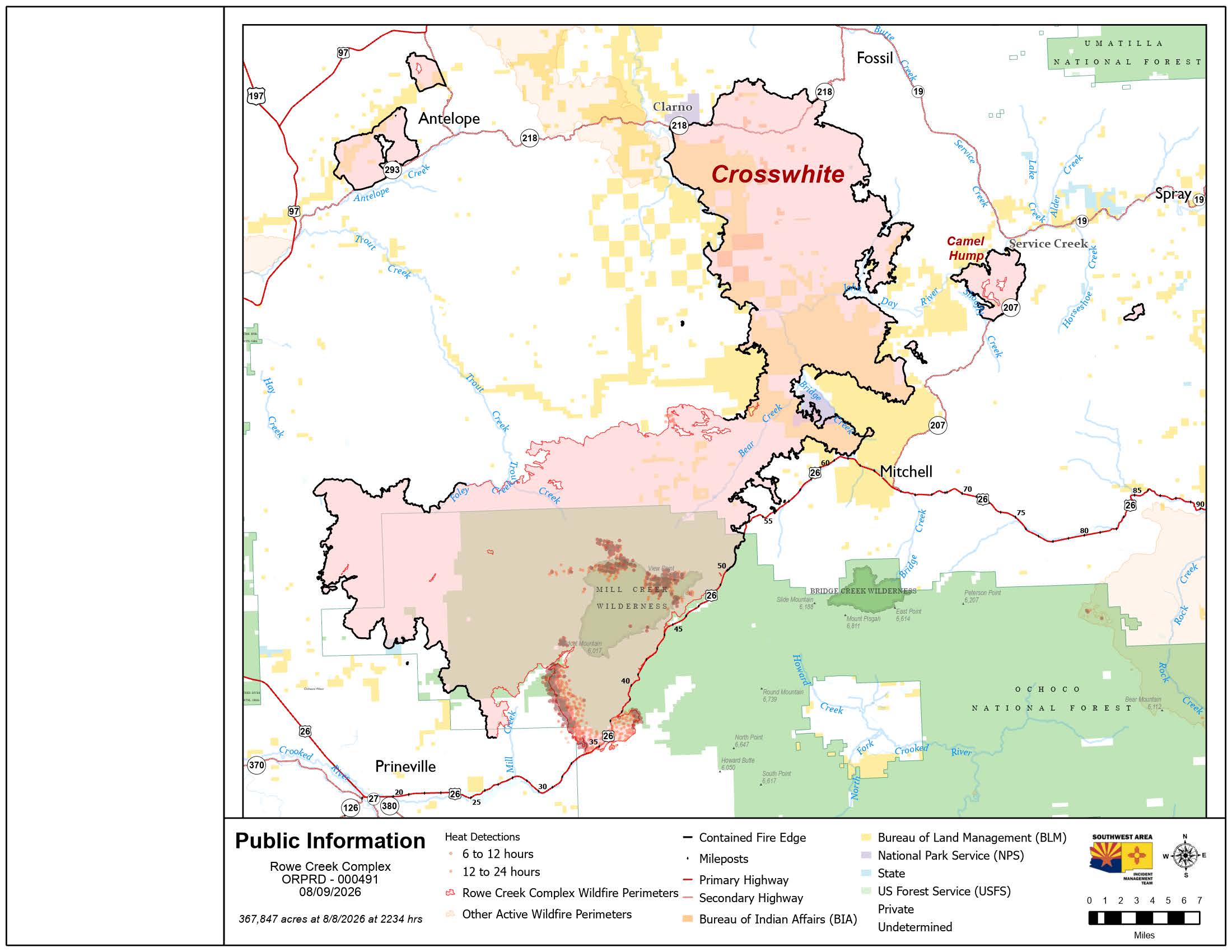 Rowe Creek Fire Map from August 9, 2026.
A new unified command began Sunday morning as the Oregon State Fire Marshal Red Team and Oregon Department of Forestry Team 2 joined Southwest Complex Incident Management Team 2. The integrated teams are splitting duties, with wildland crews focusing on the perimeter while structural task forces prioritize homes in the Mill Creek, Cougar Mountain, and Ochoco Ranger Station communities.
On the fire’s southern edge near the junctions of U.S. Highway 26 (US26), Salmon Creek Road, and County Road 23 (also known as Ochoco Creek Road and Ranger Station Road), crews successfully used bulldozers to contain a 10-acre spot fire south of Ranger Station Road. Firefighters are currently using heavy equipment to prepare Forest Service roads 2610 and 2670 to tie the fire line back into US 26.
In the western sector, crews successfully held the fire within planned lines near Cherry Creek and Tompkins Pass Road, supported by aircraft dropping water and retardant. To maximize efficiency in these remote areas, a temporary spike camp has been established to reduce travel time for ground personnel.
While higher humidity levels (up to 52 percent) helped firefighters overnight, conditions are expected to remain challenging Sunday. Forecasters expect a high of 85 degrees with humidity dropping as low as 14 percent, which could lead to "very high" fire activity and the development of large smoke columns. Fire officials warned that if these columns collapse, they can cause the fire to spread rapidly in unpredictable directions.
Highway 26 remains closed from milepost 29.2 to milepost 66. Officials warned that the road remains unsafe due to hazards including fire-weakened trees, loosened overhead rocks, and stressed bridges and roadbeds. Current road conditions can be checked at TripCheck.com.
Other closures include:
- Ochoco National Forest: Emergency closure information is at fs.usda.gov/r06/ochoco/alerts.
- Bureau of Land Management: Closure details are at blm.gov/programs/fire/regional-info/oregon-washington/fire-restrictions.
- John Day Fossil Beds National Monument: All units are now open; see nps.gov/joda/planyourvisit/conditions.htm for details.
There have been no changes to evacuation orders for Crook, Jefferson, Wasco, and Wheeler counties as of Sunday morning. Those interested in evacuation information should monitor their local sheriff's office:
- Crook County: protect.genasys.com
- Jefferson County: tinyurl.com/bdz88ufn
- Wasco County: perimetermap.com/wascocounty-or
- Wheeler County: arcg.is/1aDrHm4
A Red Cross shelter remains open at the East Side Church (3174 NE Third Street) in Prineville.
Air quality in the region continues to fluctuate rapidly, reaching levels as severe as hazardous. For detailed information, visit fire.airnow.gov.
A Temporary Flight Restriction is active over the fire area; visit tfr.faa.gov/tfr3 for more information. The public is reminded that unauthorized drone use is illegal and will immediately ground all firefighting aircraft.
For the latest official updates, the public can visit the Rowe Creek Complex Inciweb page