Firefighters have reached 62 percent containment on the lightning-caused Rowe Creek Complex, which has now burned 329,012 acres. Despite this progress, U.S. Highway 26 will remain closed to the public due to the extreme risks posed by ongoing firefighting and cleanup operations.
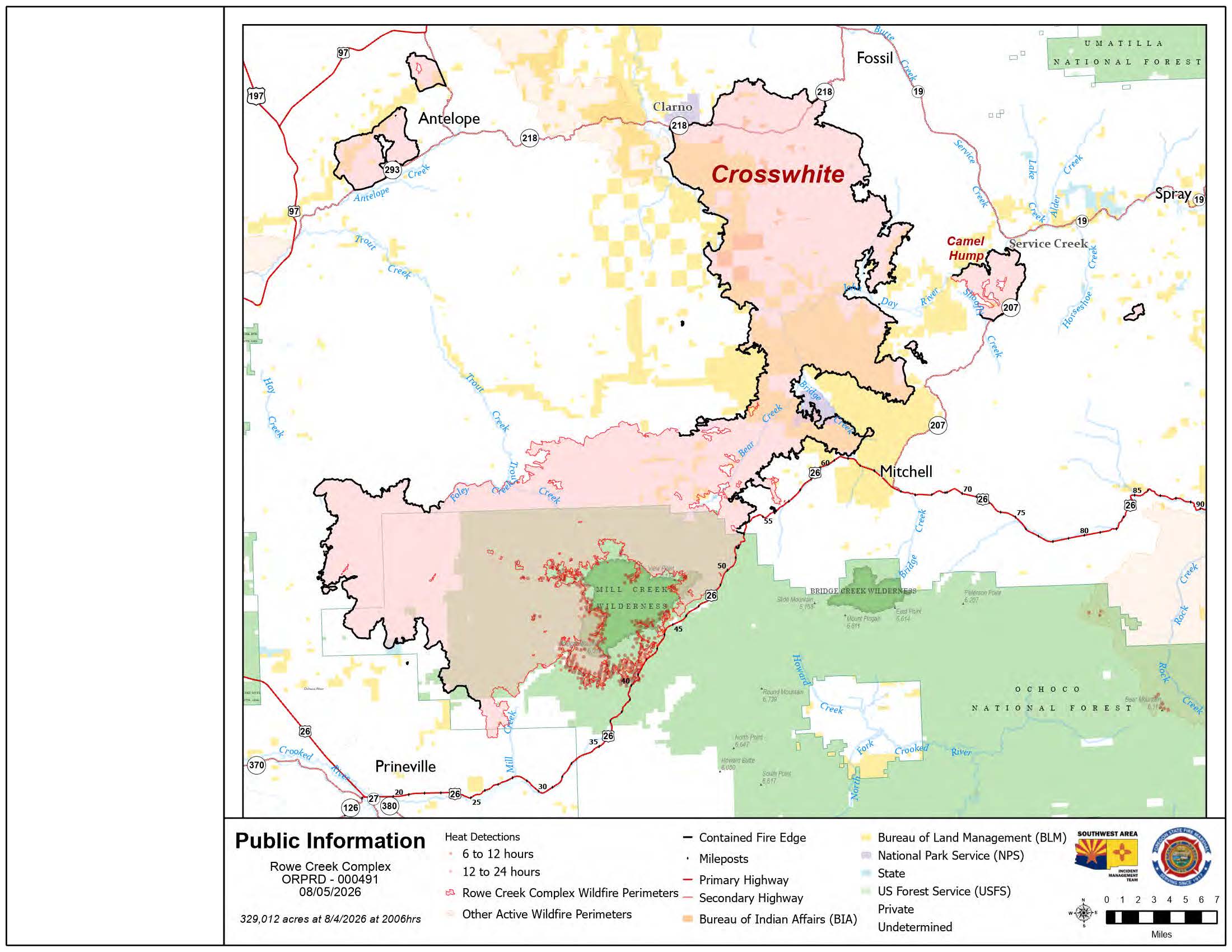 Rowe Creek Fire Map from August 5, 2026.
While crews are making steady gains, the area around Highway 26 remains a very active work zone. Firefighters are currently clearing brush, cutting down trees, and using helicopters to support burnout operations, where they intentionally burn plants to create a gap the main fire cannot cross. Once the fire work is done, the road must still be cleared of falling rocks and fire-weakened trees before it is safe for drivers.
Current Operations
- Protecting Prineville: Crews are preparing Forest Service Road 3350 for a burnout to create a buffer between the fire and the eastern edge of Prineville.
- Mill Creek: Firefighters worked through the night to put out small spot fires that jumped over containment lines.
- Trout and Cherry Creeks: Fire activity remains high in this area, but helicopters are helping ground crews keep the flames within established boundaries.
- Camel Hump: Teams successfully reached uncontained sections on the west side of the fire, though the steep and dangerous terrain remains a challenge.
Task forces mobilized by the Oregon State Fire Marshal are continuing to check homes within the fire perimeter for any hidden hotspots that could reignite. Because the threat to homes is decreasing, some extra fire teams from California are heading home today, but three task forces remain to patrol near Highway 26, Hamilton Creek, and Mill Creek Road.
A public meeting will be held Thursday, August 6, at 6:00 p.m. at Barnes Butte Elementary School (1875 NE Ironhorse Drive, Prineville). For those who cannot attend in person, the meeting will be streamed live on the official Facebook page.
Conditions will be hot and dry today, with temperatures reaching the upper 90s. Afternoon smoke columns are expected to form, and air quality has recently fluctuated between good and hazardous. Residents can track real-time conditions at fire.airnow.gov.
Important Links and Resources Evacuation Maps:
- Crook County: protect.genasys.com
- Jefferson County: tinyurl.com/bdz88ufn
- Wasco County: perimetermap.com/wascocounty-or
- Wheeler County: arg.is/1aDrHm4
Closures and Safety:
- Road Conditions: tripcheck.com
- Forest Closures: Ochoco National Forest Alerts
- Shelter: A Red Cross shelter is open at the East Side Church (3174 NE Third Street, Prineville).
- Drones: A Temporary Flight Restriction is in place; unauthorized drones are illegal and will ground all firefighting aircraft.