
The Rowe Creek Complex has grown to 294,900 acres following the merger of several large wildfires, fire officials announced Tuesday. While the total acreage increased, overall containment is now reported at 33 percent as crews reassess the combined footprint of the massive blaze.
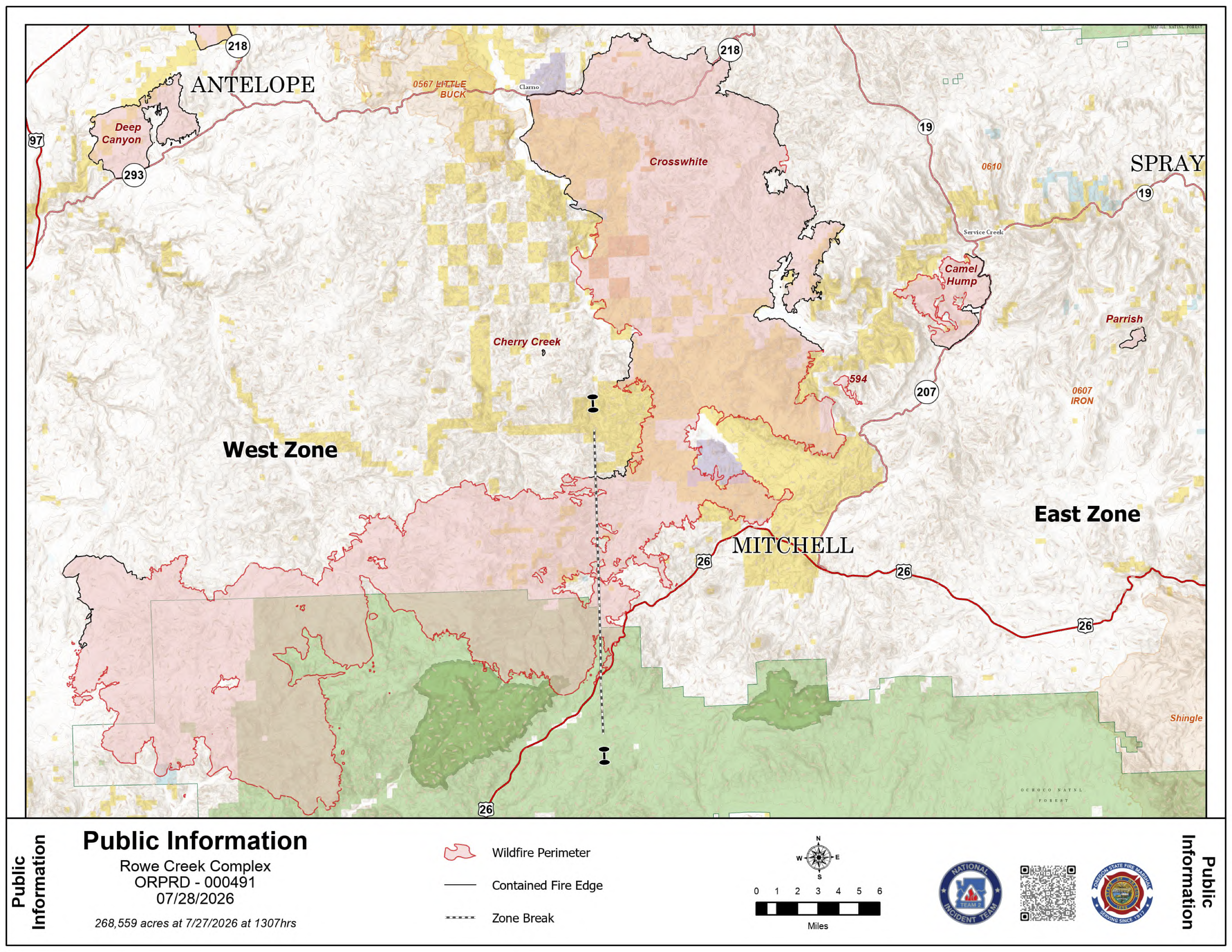 Rowe Creek Fire Map from July 28, 2026.
The Crosswhite, Brewer, and Green Mountain fires have now joined into one continuous fire area. Moving forward, the Brewer and Green Mountain fires will be managed as Crosswhite West, while the eastern portion remains Crosswhite East.
Crosswhite East and Highway 26: Crosswhite East is currently estimated at 277,296 acres and is 26 percent contained. On Monday, moderated fire behavior allowed crews to successfully patrol and mop-up the northern edge of the fire.
Tuesday, firefighters are prioritizing the southwest corner of the fire near Highway 26. This is the final working day for the Oregon State Fire Marshal structural task forces and overhead personnel. These crews will spend their last shift patrolling residential areas, supporting suppression efforts, and clearing hazard trees along the highway corridor.
Camel Hump and Incident 594
- Camel Hump Fire: This 6,614-acre fire is 37 percent contained. Firefighters are continuing to secure lines and mop-up along Highway 207, the John Day River, and Shoofly Creek.
- Incident 594: Crews have successfully built a containment line around the entire perimeter of this 298-acre fire. Today, they are focused on checking the area for any remaining heat before releasing resources to other parts of the complex.
Weather and Safety: A shift toward favorable weather is bringing relief to the region. Forecasters expect cooler temperatures, higher humidity, and lighter winds, which should continue to moderate fire behavior throughout the week. There is a chance of scattered rain and lightning later in the week before hot and dry conditions return.
Level 1, 2, and 3 evacuation notices remain in place for Wheeler and Wasco counties. Wasco County residents can view their specific zones through the Perimeter Maps dashboard.
Several public land closures remain in effect, including the John Day Fossil Beds National Monument and all Bureau of Land Management land along the John Day River from Service Creek to the Columbia River.
A Temporary Flight Restriction is active over the area. Officials remind the public that flying a drone near the fire is illegal and will force the immediate grounding of all firefighting aircraft. For the latest road conditions and closures, visit www.tripcheck.com.