
Firefighters on the Rowe Creek Complex are bracing for critical weather conditions today as the massive blaze is expected to merge with the nearby Brewer Fire. The lightning-caused complex has grown to 208,759 acres and is 31% contained.
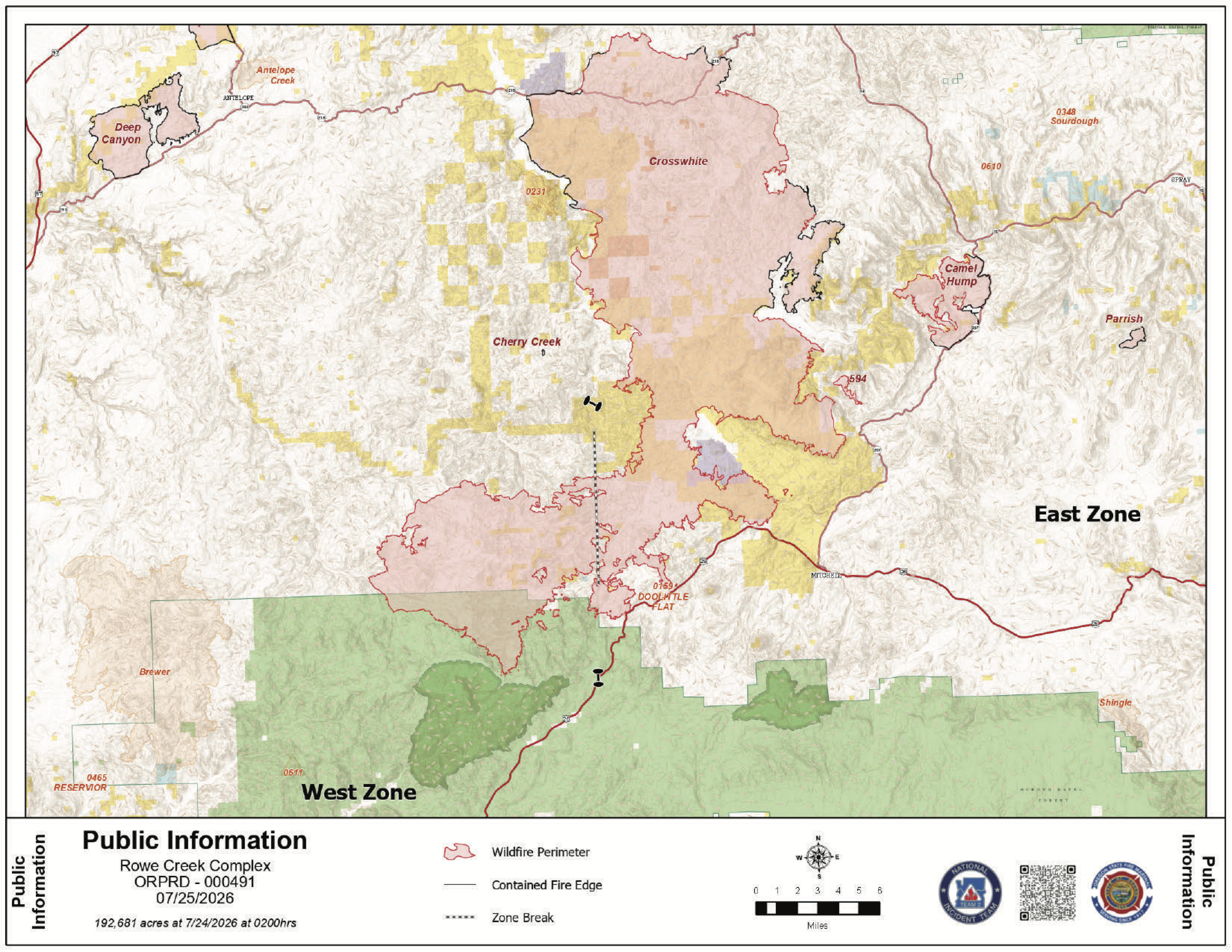 Rowe Creek Fire Map from July 26, 2026.
A Red Flag Warning is in effect from 11 a.m. to 8 p.m. Sunday due to hot, dry conditions and southwestern winds that are expected to drive active fire behavior along the southern border. While temperatures are forecast to cool later in the week, officials warn that Sunday's winds will test existing lines.
The largest portion of the complex, Crosswhite East, stands at 191,155 acres and is 21% contained. On Saturday, fire behavior increased in the south, pushing flames toward Highway 26 and west toward the Brewer Fire. To protect homes, Oregon State Fire Marshal task forces conducted strategic firing operations, intentionally burning vegetation to create a buffer, ahead of the main fire.
Sunday, crews remain focused on the southern front. Firefighters are constructing contingency lines south of Highway 26 to serve as a backup if the fire crosses the road. Strategic firing operations around homes will continue to improve structure protection while an Unmanned Aircraft System provides real-time situational awareness.
Camel Hump and Incident 594
- Camel Hump Fire: Now 37% contained at 6,614 acres. Crews are patrolling Highway 207 and securing more fire lines today.
- Incident 594: This 298-acre fire is currently 0% contained. Firefighters completed a dozer line around the perimeter on Saturday and will spend today securing that line against southwestern winds.
Safety and Evacuations Level 1, 2, and 3 evacuation notices remain in place for residents in Wheeler and Wasco counties. Residents in Wasco County can view specific updates through the Perimeter Maps dashboard.
.JPG)
.JPG)
.JPG)
.JPG)
For the most current information on road conditions and closures, including traffic impacts on Highway 26, visit www.tripcheck.com.
Public land closures remain in effect for all Bureau of Land Management land along the John Day River from Service Creek to the Columbia River. The John Day Fossil Beds National Monument also remains closed.
A Temporary Flight Restriction is active over the entire fire area. Fire officials emphasize that unauthorized drone flights are illegal and pose a serious risk to firefighters, as they will result in the immediate grounding of all aerial firefighting operations.