Containment on the Rowe Creek Complex has grown to 27 percent as firefighters reorganize resources to manage the massive 192,681-acre incident. While crews reached full containment on several smaller fires, officials are bracing for a Red Flag Warning starting this afternoon that could drive fire growth along the complex's southern edge.
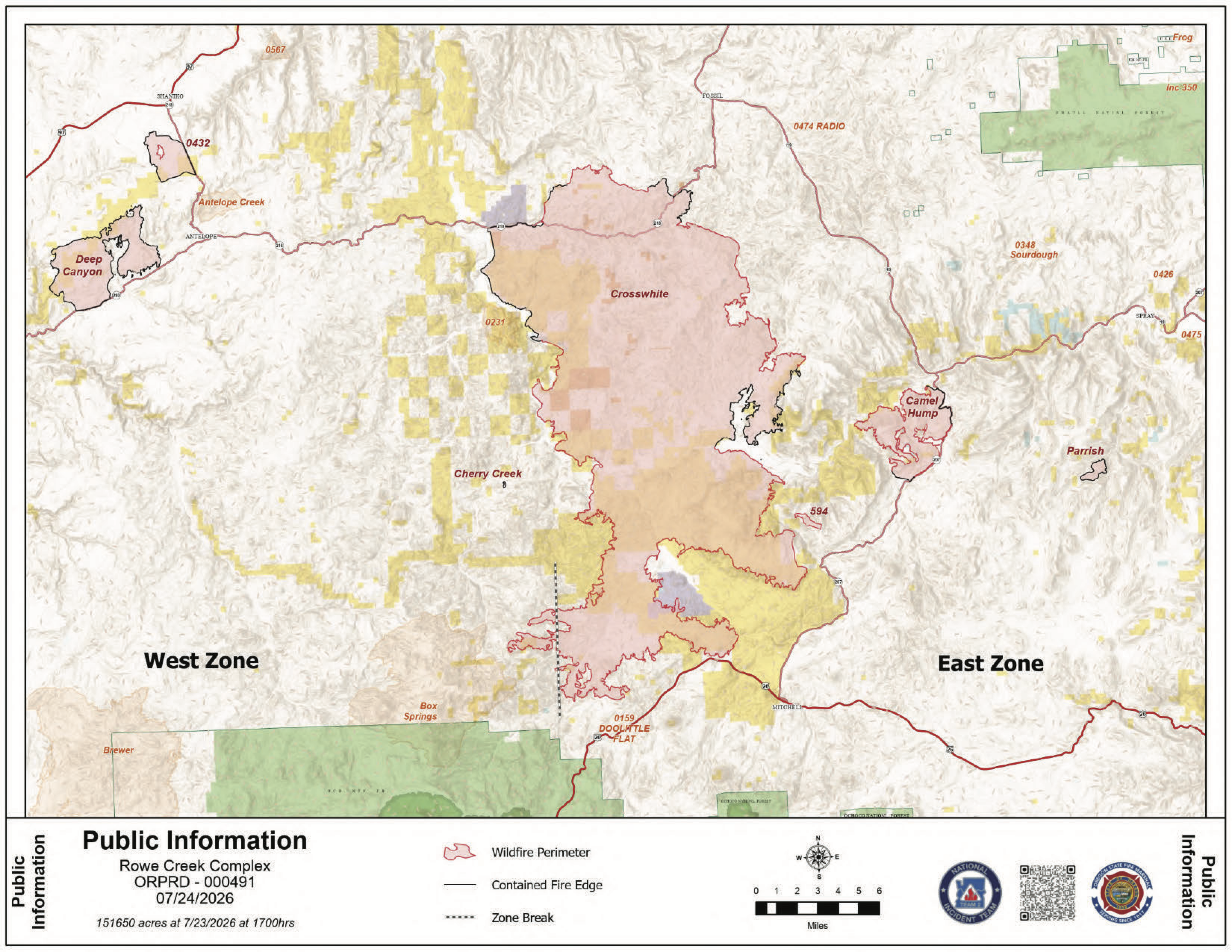 Rowe Creek Fire Map from July 24, 2026.
The complex underwent a significant change today as the Box Springs Fire merged with the Crosswhite Fire. The combined incident is now being managed as Crosswhite West and Crosswhite East, with the county line between Wheeler and Jefferson serving as the boundary. Updates for the Wheeler County portion will remain on the Rowe Creek Complex pages, while Crook and Jefferson counties updates will move to the Brewer Fire information pages.
On the 175,079-acre Crosswhite Fire, containment stands at 15 percent. While the northern perimeter saw minimal activity yesterday, the southern portion remains active near Highway 26. Early damage assessments show two small outbuildings were lost, but coordinated efforts between local fire departments, rangeland fire protection associations, and state crews have successfully prevented any homes from being destroyed.
Firefighters achieved a major milestone yesterday with the Deep Canyon and Parrish fires reaching 100 percent containment. Resources are now being moved from those areas to support more active parts of the complex. Additionally, the Cherry Creek Fire is now fully contained and secured.
Crews are also responding to a new 100-acre start, known as Incident 594, located east of Twickenham Road and south of Shoofly. On the Camel Hump Fire, which is now 37 percent contained at 6,614 acres, Oregon State Fire Marshal task forces are continuing to prep and mop up near structures while wildland crews reinforce lines along Highway 207.
Weather officials have issued a Red Flag Warning through 10 p.m. Friday. Forecasters expect high temperatures, winds over 20 mph, and zero cloud cover, which will likely increase fire behavior across the southern portion of the incident.
.JPG)
.JPG)
.JPG)
.JPG)
Level 1, 2, and 3 evacuation notices remain in effect for Wheeler and Wasco counties. Wasco County residents can monitor specific zones through the Perimeter Maps dashboard. For real-time travel updates, residents should visit www.tripcheck.com.
Several public land closures remain in place, including all Bureau of Land Management lands along the John Day River from Service Creek to the Columbia River. The National Park Service has also closed the Clarno and Painted Hills units of the John Day Fossil Beds National Monument.
A Temporary Flight Restriction is active over the area. Officials remind the public that flying a drone near the fire is illegal and will immediately ground all firefighting aircraft.