
Containment on the Rowe Creek Complex has increased to 28 percent as firefighters transition some areas to patrol status while reinforcing lines ahead of a warm and windy weekend. The lightning-caused complex remains at 149,976 acres after smoke and weather prevented an overnight infrared mapping flight.
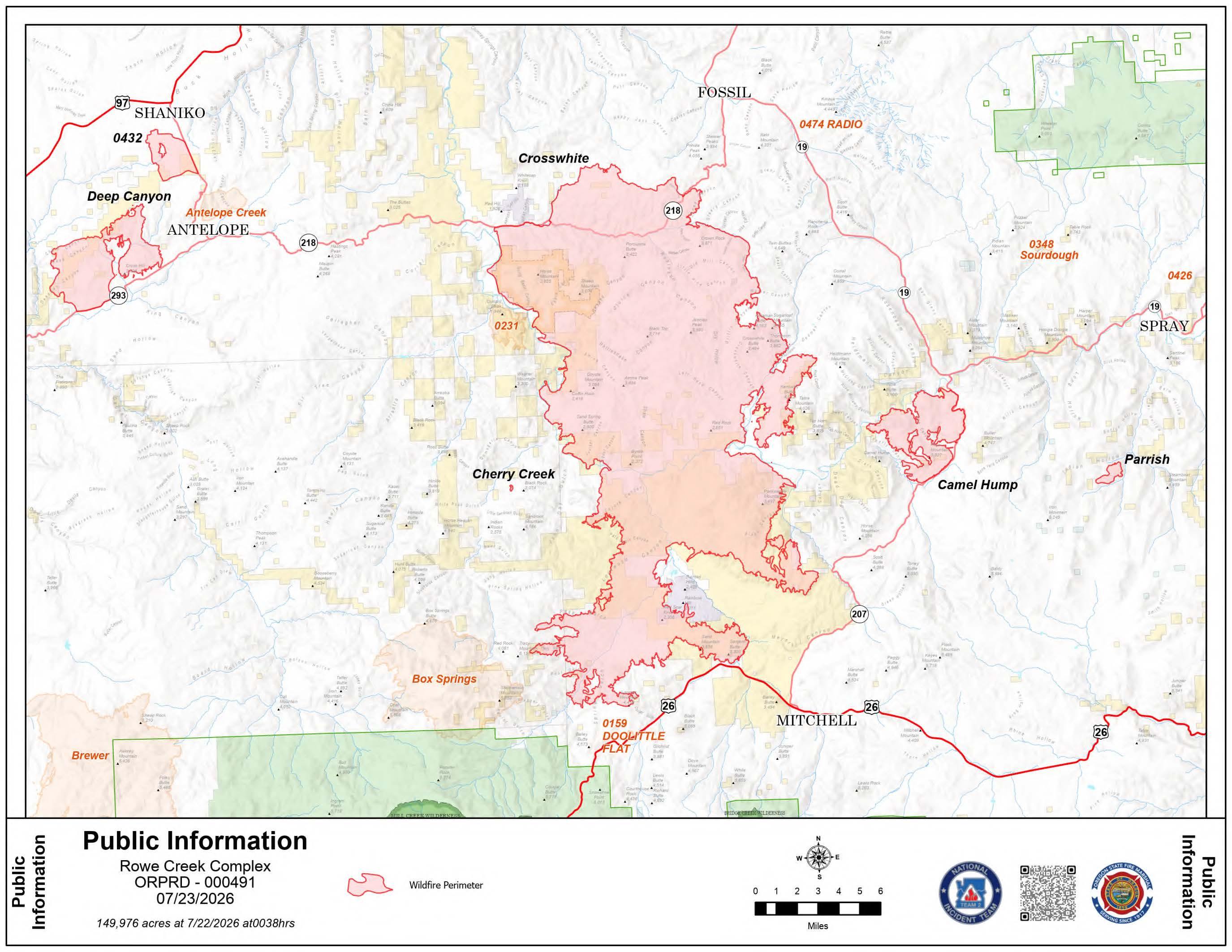 Rowe Complex Fire Map from July 23, 2026.
Rainfall from Wednesday evening's thunderstorms helped reduce fire activity overnight, but strong winds earlier in the day pushed flames north and northwest of Mitchell. Crews were repositioned to provide direct protection to threatened homes during the surge. With dry conditions expected to continue, the Oregon State Fire Marshal Green Team is coordinating structure protection with other incident management teams as the nearby Box Springs Fire shows increased activity.
Crosswhite Fire The largest fire in the complex is now 19 percent contained. Firefighters are currently working to connect dozer and hand lines north of Cougar Mountain Road and are building secondary lines as the fire moves south toward Highway 26. Mop-up operations are underway along Highway 218 and Twickenham Road to secure sections where the fire’s progress has stopped.
Fire Status Updates
- Deep Canyon Fire: Firefighters achieved 100 percent containment on Wednesday. Most resources are now relocating to help with more active areas of the complex while a small crew remains to monitor the perimeter.
- Camel Hump Fire: This 6,545-acre fire remains at 0 percent containment. The Oregon State Fire Marshal task forces are actively preparing and mopping up near structures in the area, while wildland crews reinforce lines along Highway 207 to prevent the fire from spreading into steep terrain near Shoofly Creek.
- Parrish Fire: Containment stands at 43 percent. Crews are assessing heat levels today following yesterday's rain and will continue mop-up work to strengthen the perimeter.
Safety and Closures
Level 1, 2, and 3 evacuation notices remain in effect for portions of Wheeler and Wasco counties. Those living in Wasco County can monitor specific updates through the Perimeter Maps dashboard.
Several public land closures are in place, including Bureau of Land Management lands along the John Day River from Service Creek to the Columbia River. The National Park Service has also closed the Clarno and Painted Hills units of the John Day Fossil Beds National Monument.
A temporary flight restriction is active over the area. Officials remind the public that flying a drone near the fire is illegal and will immediately ground all firefighting aircraft.
.JPG)
.JPG)
.JPG)
.JPG)