Firefighters are working to secure control lines today as a localized Red Flag Warning goes into effect for Central Oregon. The Oregon State Fire Marshal Red Incident Management Team, led by Incident Commander Ian Yocum, is overseeing structural protection efforts on both the Akawa Butte and Brewer fires in unified command with the Oregon Department of Forestry.
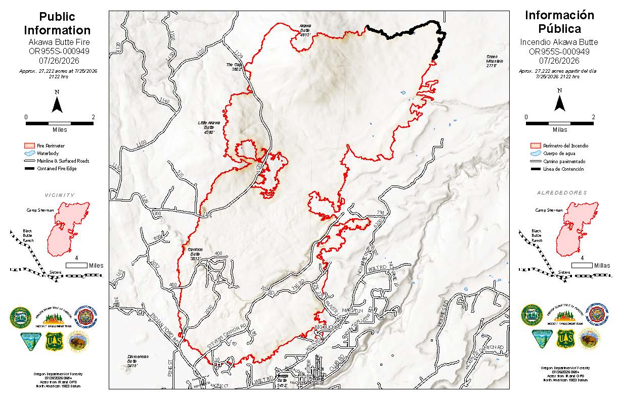 Akawa Butte Fire Map from July 26, 2026.
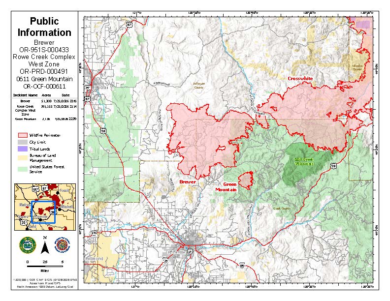 Brewer Fire Map from July 26, 2026.
The Akawa Butte Fire is currently estimated at 27,222 acres and is 5 percent contained. Overnight Saturday, crews successfully held lines during high winds and extinguished new spot fires. Operations personnel expect to have control lines fully established around the entire fire area later today, though they emphasize that full containment will require mopping up hot spots 200 to 300 feet deep into the interior.
Due to evolving priorities across the region, some Oregon State Fire Marshal resources are being reassigned from this incident to assist with the nearby Bench Fire. However, officials state that the required structural protection capability for the Akawa Butte area is being maintained.
Near Prineville, the Brewer Fire has grown to 51,308 acres and is 5 percent contained. Firefighters made significant progress overnight Saturday, allowing the northwest corner of the fire to transition to patrol status. Resources are now shifting to the west side to strengthen lines near Grizzly Road and Lofton Creek Road while continuing home protection near McKay Creek Road.
Fire managers expect the Brewer Fire to merge later today with the 191,155-acre Crosswhite West Fire, which is currently 31 percent contained. To prepare for this, crews have installed water delivery systems and completed extensive structure protection in the Marks Creek neighborhood and at the Ochoco Christian Conference Center. Traffic impacts are expected on Highway 26 as the fire moves toward the corridor.
Weather and Safety: Critical fire weather is expected from 11 a.m. through 9 p.m. today, with strong winds and high temperatures likely to increase fire activity. In addition to the larger blazes, crews are also managing the Green Mountain Fire, which is currently estimated at 2,136 acres with no containment.
Level 1, 2, and 3 evacuation notices remain in place for portions of Deschutes, Jefferson, Crook, and Wheeler counties. For the most current information, residents should visit the following resources:
.JPG)
.JPG)
A Temporary Flight Restriction is in place over the fire areas. Officials remind the public that flying a drone near a wildfire is illegal and will immediately ground all firefighting aircraft. Current air quality and smoke outlooks are available at airnow.gov.