Firefighters are working to secure control lines and defend homes today as a major weather system approaches Central Oregon. The Akawa Butte and Brewer fires, both sparked by lightning earlier this month, remain active following a night of significant fire growth and successful efforts to stop spot fires.
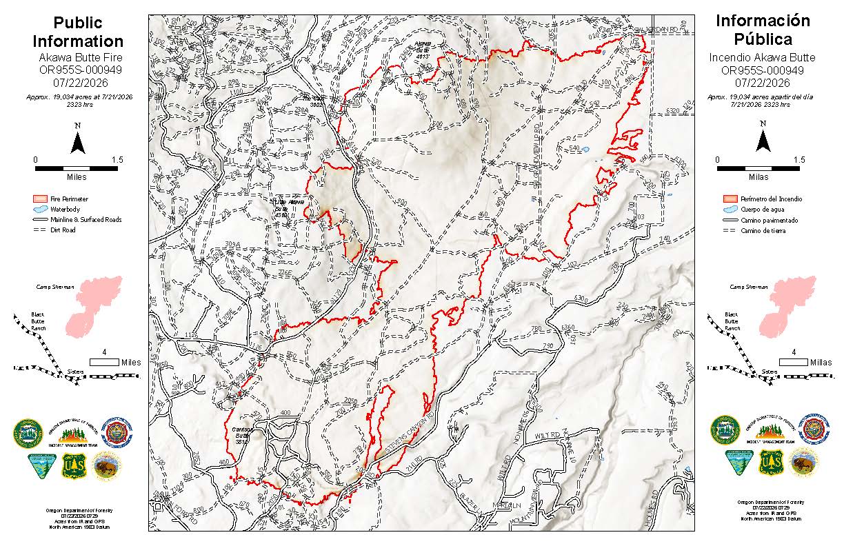 Akawa Butte Fire Map from July 22, 2026.
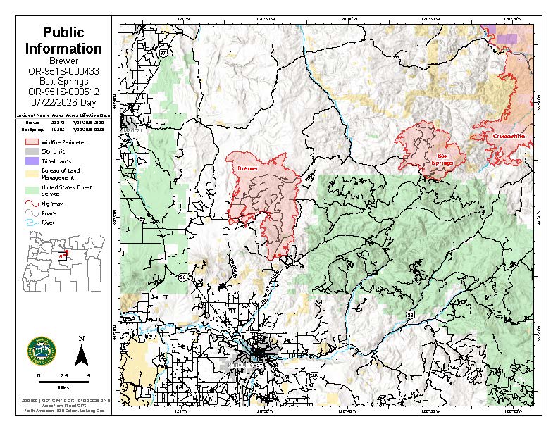 Brewer Fire Map from July 22, 2026.
A Red Flag Warning is in effect today through 11 p.m. due to the threat of abundant lightning, atmospheric instability, and erratic wind gusts up to 45 mph. While there is a chance of rain later this afternoon, officials warn that lightning without significant moisture could spark new fires in the region.
Akawa Butte Fire The Akawa Butte Fire grew by more than 5,400 acres overnight and is now estimated at 19,034 acres with 3 percent containment. Night crews successfully held established lines on the north and east perimeters while securing 1.5 miles of dozer line along Grandview Loop Road.
Today, four additional structural task forces are arriving to protect homes near Indian Ford and Wilt roads. Heavy equipment is also working to establish control lines on Forest Service Road 11. Firefighters may conduct tactical firing operations today, intentionally burning vegetation under controlled conditions, to remove fuel ahead of the main fire.
Brewer and Box Springs Fires Near Prineville, firefighters increased containment on the Brewer Fire to 5 percent, though the fire has grown to 29,878 acres. The nearby Box Springs Fire is estimated at 15,203 acres with 0 percent containment.
Oregon State Fire Marshal task forces are focused on point protection and mop-up around threatened homes in the Lofton Creek and Grizzly Road areas. Overnight, crews successfully caught several spot fires and a slopover, where the fire crosses a control line, near Lofton Creek Road. Today’s priority is expanding direct control lines on the eastern edge of the Brewer Fire while patrolling the southern and western flanks.
Public Safety and Information Level 1, 2, and 3 evacuation notices remain in effect for portions of Deschutes, Jefferson, and Crook counties. Several public land closures are also in place, including areas managed by the Bureau of Land Management and the Deschutes National Forest.
A Temporary Flight Restriction is active over the fire areas. Officials remind the public that unauthorized drone flights are illegal; if you fly, firefighting aircraft must be grounded.
An in-person community meeting for the Akawa Butte Fire is scheduled for Thursday, July 23, at 6:30 p.m. at the Sisters High School Auditorium. The meeting will also be livestreamed on the Sisters-Camp Sherman Fire District Facebook page.