Firefighters have increased containment to 31% on the Rowe Creek Complex as they prepare for a day of increased fire activity. The lightning-caused complex, which has now burned 199,047 acres, saw no significant growth on Friday despite challenging weather conditions.
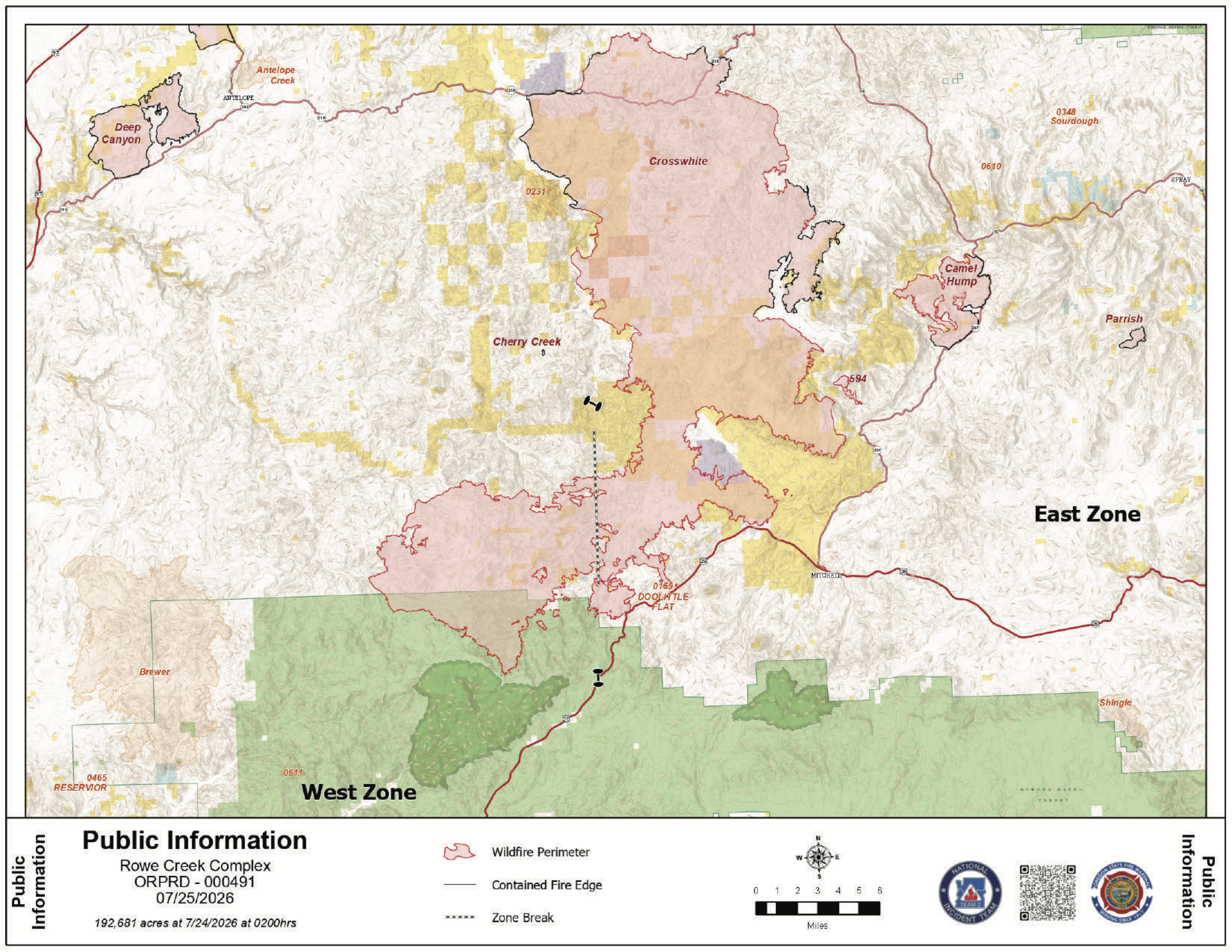 Rowe Creek Fire Map from July 25, 2026.
A Red Flag Warning remains in effect until 10 p.m. tonight. Forecasters expect high temperatures, low humidity, and wind gusts up to 25 mph, which could cause the fire to flare up, particularly on its eastern and southern edges. Temperatures are expected to begin cooling on Sunday.
The largest portion of the complex, known as Crosswhite East, has burned 181,443 acres and is 20% contained. The recent increase in reported acreage is due to more accurate mapping rather than new fire growth.
Firefighters are making steady progress on the northern side of the fire, where they are patrolling and extinguishing hot spots deep into the interior,. On the southern edge, the Oregon State Fire Marshal is working to keep the fire north of Highway 26. Crews are currently preparing the highway for potential burnout operations, intentionally clearing vegetation to create a buffer, in coordination with the neighboring Crosswhite West teams.
Structural task forces also remain focused on protecting homes in the Cougar Mountain area and reinforcing backup lines along Highway 207 down to Girds Creek,.
Camel Hump and Incident 594
- Camel Hump Fire: Now 37% contained at 6,614 acres. Crews are working to strengthen the perimeter by extinguishing heat further into the burned area. Firefighters from this incident also helped respond to three new lightning-caused fires nearby on Friday.
- Incident 594: This 298-acre fire remains at 0% containment. While the eastern side has shown little heat, the western edge remains active. Crews successfully built a primary line around the fire overnight and are working to strengthen it today,.
Safety and EvacuationsLevel 1, 2, and 3 evacuation notices remain in effect for Wheeler and Wasco counties. Wasco County residents can monitor specific zones through the Perimeter Maps dashboard.
.JPG)
.JPG)
.JPG)
.JPG)
Several public land closures are in place, including all Bureau of Land Management lands along the John Day River from Service Creek to the Columbia River. Additionally, the National Park Service has closed the Clarno and Painted Hills units of the John Day Fossil Beds National Monument.
A Temporary Flight Restriction is active over the area. Officials remind the public that flying a drone near the fire is illegal and will immediately ground all firefighting aircraft.